
Roadworks in Cinderford
There are approximately 34 roadworks within 5 miles of Cinderford today.
26 closures4 sets of traffic lights4 other works
Data last updated: 23 Oct 2026, 13:59 (UK time)
Planning ahead? See planned roadworks in Cinderford for the next 7 days
At a glance
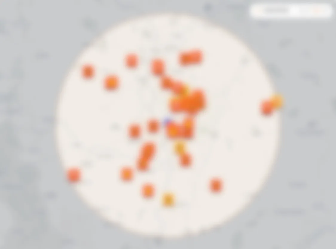
Tap any marker to open the full map · use two fingers to pan
All roadworks
Quick filter
Towns
Show
34 works active roadworks
Live now
- Live
Hope Mansell Lane From C1275 To School Lane, Hope Mansell
Road closedEnds in 3d 1hHerefordshire Council
LiveHope Mansell Lane From C1275 To School Lane, Hope Mansell
Road closedEnds in 3d 1hHerefordshire Council
- Live
B4234 From Church Road To Mireystock Cross Roads, Lydbrook
Road closedEnds in 3d 8hGloucestershire County Council
LiveB4234 From Church Road To Mireystock Cross Roads, Lydbrook
Road closedEnds in 3d 8hGloucestershire County Council
- Live
Coppice Road, Lydbrook
Road closedEnds in 16d 1hGloucestershire County Council
LiveCoppice Road, Lydbrook
Road closedEnds in 16d 1hGloucestershire County Council
- Live
Fairmoor Close, Parkend
Road closedAwaiting end confirmationGloucestershire County Council
LiveFairmoor Close, Parkend
Road closedAwaiting end confirmationGloucestershire County Council
- Live
Mount Pleasant, Parkend
Road closedAwaiting end confirmationGloucestershire County Council
LiveMount Pleasant, Parkend
Road closedAwaiting end confirmationGloucestershire County Council
- Live
Moseley Green, Parkend
Road closedAwaiting end confirmationGloucestershire County Council
LiveMoseley Green, Parkend
Road closedAwaiting end confirmationGloucestershire County Council
- Live
Lower Road, Yorkley
Road closedAwaiting end confirmationGloucestershire County Council
LiveLower Road, Yorkley
Road closedAwaiting end confirmationGloucestershire County Council
- Live
Stag Hill, Yorkley
Road closedAwaiting end confirmationGloucestershire County Council
LiveStag Hill, Yorkley
Road closedAwaiting end confirmationGloucestershire County Council
- Live
Lydney Road, Yorkley
Road closedAwaiting end confirmationGloucestershire County Council
LiveLydney Road, Yorkley
Road closedAwaiting end confirmationGloucestershire County Council
- Live
Slade Road, Yorkley
Road closedAwaiting end confirmationGloucestershire County Council
LiveSlade Road, Yorkley
Road closedAwaiting end confirmationGloucestershire County Council
- Live
Oldcroft Road, Lydney
Road closedAwaiting end confirmationGloucestershire County Council
LiveOldcroft Road, Lydney
Road closedAwaiting end confirmationGloucestershire County Council
- Live
Harold Road, Yorkley
Road closedAwaiting end confirmationGloucestershire County Council
LiveHarold Road, Yorkley
Road closedAwaiting end confirmationGloucestershire County Council
- Live
Johnsons Way, Yorkley
Road closedAwaiting end confirmationGloucestershire County Council
LiveJohnsons Way, Yorkley
Road closedAwaiting end confirmationGloucestershire County Council
- Live
Ash Grove Place, Lydney
Road closedAwaiting end confirmationGloucestershire County Council
LiveAsh Grove Place, Lydney
Road closedAwaiting end confirmationGloucestershire County Council
- Live
4/5050 Off 3/16 To Aisne Road, Lydney
Road closedAwaiting end confirmationGloucestershire County Council
Live4/5050 Off 3/16 To Aisne Road, Lydney
Road closedAwaiting end confirmationGloucestershire County Council
- Live
Aisne Road, Oldcroft
Road closedAwaiting end confirmationGloucestershire County Council
LiveAisne Road, Oldcroft
Road closedAwaiting end confirmationGloucestershire County Council
- Live
St Swithins Road, Oldcroft
Road closedAwaiting end confirmationGloucestershire County Council
LiveSt Swithins Road, Oldcroft
Road closedAwaiting end confirmationGloucestershire County Council
- Live
Track From Junction At Spinning Wheel Cottage To Lantern Cottage, Viney Hill
Road closedAwaiting end confirmationGloucestershire County Council
LiveTrack From Junction At Spinning Wheel Cottage To Lantern Cottage, Viney Hill
Road closedAwaiting end confirmationGloucestershire County Council
- Live
Road From Junction With New Road To Parkend Primary School, Parkend
Road closedAwaiting end confirmationGloucestershire County Council
LiveRoad From Junction With New Road To Parkend Primary School, Parkend
Road closedAwaiting end confirmationGloucestershire County Council
- Live
Yorkley Road, Parkend
Road closedAwaiting end confirmationGloucestershire County Council
LiveYorkley Road, Parkend
Road closedAwaiting end confirmationGloucestershire County Council
- Live
Parkend Road, Yorkley
Road closedAwaiting end confirmationGloucestershire County Council
LiveParkend Road, Yorkley
Road closedAwaiting end confirmationGloucestershire County Council
- Live
Parkend Road, Lydney
Road closedAwaiting end confirmationGloucestershire County Council
LiveParkend Road, Lydney
Road closedAwaiting end confirmationGloucestershire County Council
- Live
Bailey Hill, Yorkley
Road closedAwaiting end confirmationGloucestershire County Council
LiveBailey Hill, Yorkley
Road closedAwaiting end confirmationGloucestershire County Council
- Live
Road From Junction With Oldcroft Road To Junction With Ash Grove Place, Yorkley
Road closedAwaiting end confirmationGloucestershire County Council
LiveRoad From Junction With Oldcroft Road To Junction With Ash Grove Place, Yorkley
Road closedAwaiting end confirmationGloucestershire County Council
- Live
Viney Hill Road, Lydney
Road closedAwaiting end confirmationGloucestershire County Council
LiveViney Hill Road, Lydney
Road closedAwaiting end confirmationGloucestershire County Council
- Live
Road From Junction With St Swithins Road To Junction With Pine Tree Way, Viney Hill
Road closedAwaiting end confirmationGloucestershire County Council
LiveRoad From Junction With St Swithins Road To Junction With Pine Tree Way, Viney Hill
Road closedAwaiting end confirmationGloucestershire County Council
- Live
New Road, Parkend
Multi-way traffic lightsAwaiting end confirmationGloucestershire County Council
LiveNew Road, Parkend
Multi-way traffic lightsAwaiting end confirmationGloucestershire County Council
- Live
Road From Junction With St Swithins Road To Junction With Pine Tree Way, Viney Hill
Two-way traffic lightsAwaiting end confirmationGloucestershire County Council
LiveRoad From Junction With St Swithins Road To Junction With Pine Tree Way, Viney Hill
Two-way traffic lightsAwaiting end confirmationGloucestershire County Council
- Live
Speech House Road, Broadwell
Multi-way traffic lightsEnds in 4d 8hNational Grid Electricity Distribution (west Midlands)
LiveSpeech House Road, Broadwell
Multi-way traffic lightsEnds in 4d 8hNational Grid Electricity Distribution (west Midlands)
- Live
Ross Road, Lydbrook
Two-way traffic lightsEnds in 5d 8hGloucestershire County Council
LiveRoss Road, Lydbrook
Two-way traffic lightsEnds in 5d 8hGloucestershire County Council
- Live
Sneyd Wood Road, Cinderford
Take turns to passEnds in 2d 0hSevern Trent Water
LiveSneyd Wood Road, Cinderford
Take turns to passEnds in 2d 0hSevern Trent Water
- Live
Church Road, Arlingham
Works on the roadEnds in 1d 2hSevern Trent Water
LiveChurch Road, Arlingham
Works on the roadEnds in 1d 2hSevern Trent Water
- Live
Abbots View, Ruspidge
Off-road worksEnds in 8h 37mNational Grid Electricity Distribution (west Midlands)
LiveAbbots View, Ruspidge
Off-road worksEnds in 8h 37mNational Grid Electricity Distribution (west Midlands)
- Live
Belle Vue Road, Cinderford
Off-road worksEnds in 2d 8hGloucestershire County Council
LiveBelle Vue Road, Cinderford
Off-road worksEnds in 2d 8hGloucestershire County Council
What's happening in Cinderford?
No account needed. Random nickname on this device. Privacy
Loading comments…
This page shows every active roadwork inside the area — closures, lane restrictions, two-way lights, give-and-take systems and works without traffic management. The road closures page is the same data narrowed down to full closures and lane closures only.
Some works are submitted by multiple promoters (the council and a utility, for example) or are split across more than one permit. We try to group these where the references match, but if you spot duplicates please send us a note and we'll tighten the dedupe.
Only works promoters are legally required to notify on Street Manager appear here. Emergency closures for flooding, local events or short-notice council decisions go through a different process — your local council's website or social channels is usually the quickest source for those.
Local roads come from the UK Department for Transport's Street Manager service. Motorways and trunk roads come from National Highways. This page is rebuilt four times a day so counts and listings stay fresh, and we don't modify or filter what promoters submit.
More questions? Visit our support page
Don't get caught out
Is your commute through Cinderford clear tomorrow?
At a glance
All roadworks
Quick filter
Towns
Show
34 works active roadworks
Live now
- Live
Hope Mansell Lane From C1275 To School Lane, Hope Mansell
Road closedEnds in 3d 1hHerefordshire Council
LiveHope Mansell Lane From C1275 To School Lane, Hope Mansell
Road closedEnds in 3d 1hHerefordshire Council
- Live
B4234 From Church Road To Mireystock Cross Roads, Lydbrook
Road closedEnds in 3d 8hGloucestershire County Council
LiveB4234 From Church Road To Mireystock Cross Roads, Lydbrook
Road closedEnds in 3d 8hGloucestershire County Council
- Live
Coppice Road, Lydbrook
Road closedEnds in 16d 1hGloucestershire County Council
LiveCoppice Road, Lydbrook
Road closedEnds in 16d 1hGloucestershire County Council
- Live
Fairmoor Close, Parkend
Road closedAwaiting end confirmationGloucestershire County Council
LiveFairmoor Close, Parkend
Road closedAwaiting end confirmationGloucestershire County Council
- Live
Mount Pleasant, Parkend
Road closedAwaiting end confirmationGloucestershire County Council
LiveMount Pleasant, Parkend
Road closedAwaiting end confirmationGloucestershire County Council
- Live
Moseley Green, Parkend
Road closedAwaiting end confirmationGloucestershire County Council
LiveMoseley Green, Parkend
Road closedAwaiting end confirmationGloucestershire County Council
- Live
Lower Road, Yorkley
Road closedAwaiting end confirmationGloucestershire County Council
LiveLower Road, Yorkley
Road closedAwaiting end confirmationGloucestershire County Council
- Live
Stag Hill, Yorkley
Road closedAwaiting end confirmationGloucestershire County Council
LiveStag Hill, Yorkley
Road closedAwaiting end confirmationGloucestershire County Council
- Live
Lydney Road, Yorkley
Road closedAwaiting end confirmationGloucestershire County Council
LiveLydney Road, Yorkley
Road closedAwaiting end confirmationGloucestershire County Council
- Live
Slade Road, Yorkley
Road closedAwaiting end confirmationGloucestershire County Council
LiveSlade Road, Yorkley
Road closedAwaiting end confirmationGloucestershire County Council
- Live
Oldcroft Road, Lydney
Road closedAwaiting end confirmationGloucestershire County Council
LiveOldcroft Road, Lydney
Road closedAwaiting end confirmationGloucestershire County Council
- Live
Harold Road, Yorkley
Road closedAwaiting end confirmationGloucestershire County Council
LiveHarold Road, Yorkley
Road closedAwaiting end confirmationGloucestershire County Council
- Live
Johnsons Way, Yorkley
Road closedAwaiting end confirmationGloucestershire County Council
LiveJohnsons Way, Yorkley
Road closedAwaiting end confirmationGloucestershire County Council
- Live
Ash Grove Place, Lydney
Road closedAwaiting end confirmationGloucestershire County Council
LiveAsh Grove Place, Lydney
Road closedAwaiting end confirmationGloucestershire County Council
- Live
4/5050 Off 3/16 To Aisne Road, Lydney
Road closedAwaiting end confirmationGloucestershire County Council
Live4/5050 Off 3/16 To Aisne Road, Lydney
Road closedAwaiting end confirmationGloucestershire County Council
- Live
Aisne Road, Oldcroft
Road closedAwaiting end confirmationGloucestershire County Council
LiveAisne Road, Oldcroft
Road closedAwaiting end confirmationGloucestershire County Council
- Live
St Swithins Road, Oldcroft
Road closedAwaiting end confirmationGloucestershire County Council
LiveSt Swithins Road, Oldcroft
Road closedAwaiting end confirmationGloucestershire County Council
- Live
Track From Junction At Spinning Wheel Cottage To Lantern Cottage, Viney Hill
Road closedAwaiting end confirmationGloucestershire County Council
LiveTrack From Junction At Spinning Wheel Cottage To Lantern Cottage, Viney Hill
Road closedAwaiting end confirmationGloucestershire County Council
- Live
Road From Junction With New Road To Parkend Primary School, Parkend
Road closedAwaiting end confirmationGloucestershire County Council
LiveRoad From Junction With New Road To Parkend Primary School, Parkend
Road closedAwaiting end confirmationGloucestershire County Council
- Live
Yorkley Road, Parkend
Road closedAwaiting end confirmationGloucestershire County Council
LiveYorkley Road, Parkend
Road closedAwaiting end confirmationGloucestershire County Council
- Live
Parkend Road, Yorkley
Road closedAwaiting end confirmationGloucestershire County Council
LiveParkend Road, Yorkley
Road closedAwaiting end confirmationGloucestershire County Council
- Live
Parkend Road, Lydney
Road closedAwaiting end confirmationGloucestershire County Council
LiveParkend Road, Lydney
Road closedAwaiting end confirmationGloucestershire County Council
- Live
Bailey Hill, Yorkley
Road closedAwaiting end confirmationGloucestershire County Council
LiveBailey Hill, Yorkley
Road closedAwaiting end confirmationGloucestershire County Council
- Live
Road From Junction With Oldcroft Road To Junction With Ash Grove Place, Yorkley
Road closedAwaiting end confirmationGloucestershire County Council
LiveRoad From Junction With Oldcroft Road To Junction With Ash Grove Place, Yorkley
Road closedAwaiting end confirmationGloucestershire County Council
- Live
Viney Hill Road, Lydney
Road closedAwaiting end confirmationGloucestershire County Council
LiveViney Hill Road, Lydney
Road closedAwaiting end confirmationGloucestershire County Council
- Live
Road From Junction With St Swithins Road To Junction With Pine Tree Way, Viney Hill
Road closedAwaiting end confirmationGloucestershire County Council
LiveRoad From Junction With St Swithins Road To Junction With Pine Tree Way, Viney Hill
Road closedAwaiting end confirmationGloucestershire County Council
- Live
New Road, Parkend
Multi-way traffic lightsAwaiting end confirmationGloucestershire County Council
LiveNew Road, Parkend
Multi-way traffic lightsAwaiting end confirmationGloucestershire County Council
- Live
Road From Junction With St Swithins Road To Junction With Pine Tree Way, Viney Hill
Two-way traffic lightsAwaiting end confirmationGloucestershire County Council
LiveRoad From Junction With St Swithins Road To Junction With Pine Tree Way, Viney Hill
Two-way traffic lightsAwaiting end confirmationGloucestershire County Council
- Live
Speech House Road, Broadwell
Multi-way traffic lightsEnds in 4d 8hNational Grid Electricity Distribution (west Midlands)
LiveSpeech House Road, Broadwell
Multi-way traffic lightsEnds in 4d 8hNational Grid Electricity Distribution (west Midlands)
- Live
Ross Road, Lydbrook
Two-way traffic lightsEnds in 5d 8hGloucestershire County Council
LiveRoss Road, Lydbrook
Two-way traffic lightsEnds in 5d 8hGloucestershire County Council
- Live
Sneyd Wood Road, Cinderford
Take turns to passEnds in 2d 0hSevern Trent Water
LiveSneyd Wood Road, Cinderford
Take turns to passEnds in 2d 0hSevern Trent Water
- Live
Church Road, Arlingham
Works on the roadEnds in 1d 2hSevern Trent Water
LiveChurch Road, Arlingham
Works on the roadEnds in 1d 2hSevern Trent Water
- Live
Abbots View, Ruspidge
Off-road worksEnds in 8h 37mNational Grid Electricity Distribution (west Midlands)
LiveAbbots View, Ruspidge
Off-road worksEnds in 8h 37mNational Grid Electricity Distribution (west Midlands)
- Live
Belle Vue Road, Cinderford
Off-road worksEnds in 2d 8hGloucestershire County Council
LiveBelle Vue Road, Cinderford
Off-road worksEnds in 2d 8hGloucestershire County Council
What's happening in Cinderford?
No account needed. Random nickname on this device. Privacy
Loading comments…
This page shows every active roadwork inside the area — closures, lane restrictions, two-way lights, give-and-take systems and works without traffic management. The road closures page is the same data narrowed down to full closures and lane closures only.
Some works are submitted by multiple promoters (the council and a utility, for example) or are split across more than one permit. We try to group these where the references match, but if you spot duplicates please send us a note and we'll tighten the dedupe.
Only works promoters are legally required to notify on Street Manager appear here. Emergency closures for flooding, local events or short-notice council decisions go through a different process — your local council's website or social channels is usually the quickest source for those.
Local roads come from the UK Department for Transport's Street Manager service. Motorways and trunk roads come from National Highways. This page is rebuilt four times a day so counts and listings stay fresh, and we don't modify or filter what promoters submit.
More questions? Visit our support page
Don't get caught out